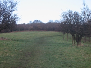
View from north to south. View from south to north.
Visible across the grass field are lines of ridge and furrow, a medieval field system of cultivation, which surprisingly has survived the effects of past industrial activity, especially the nearby extensive coal mining. Some of the lines run downhill, from north to south, but in some areas run across from east to west, and are particularly clear at dawn, dusk, in heavy frost or after light snow. The land here was worked until the 1960s, and belonged to Warrens Hall and its farm, both which were located on higher ground on the other side of the Dudley Road. Warrens Hall was a manor house (possibly moated) recorded on an 1835 parish plan, and later became a farm, but was demolished by 1884. Warrens Hall Farm still exists as a riding school higher up the hill-side off the Oakham Road.
Walk across the field, parallel to a fence and the Dudley Road, and turn left downhill on the grass path to the right of the field, with a hedge on the right, and continue ahead to a junction with a path, with an information panel opposite. Bear right down a narrow path with bushes either side, and football pitches possibly visible to the right through the trees. At ground level on either side are visible remains of brickwork and rocks, which are the remains of a reservoir dam wall.


